-

Safe Travels
-

-

-

-


The problem:
Crime in Philadelphia
Our solution:
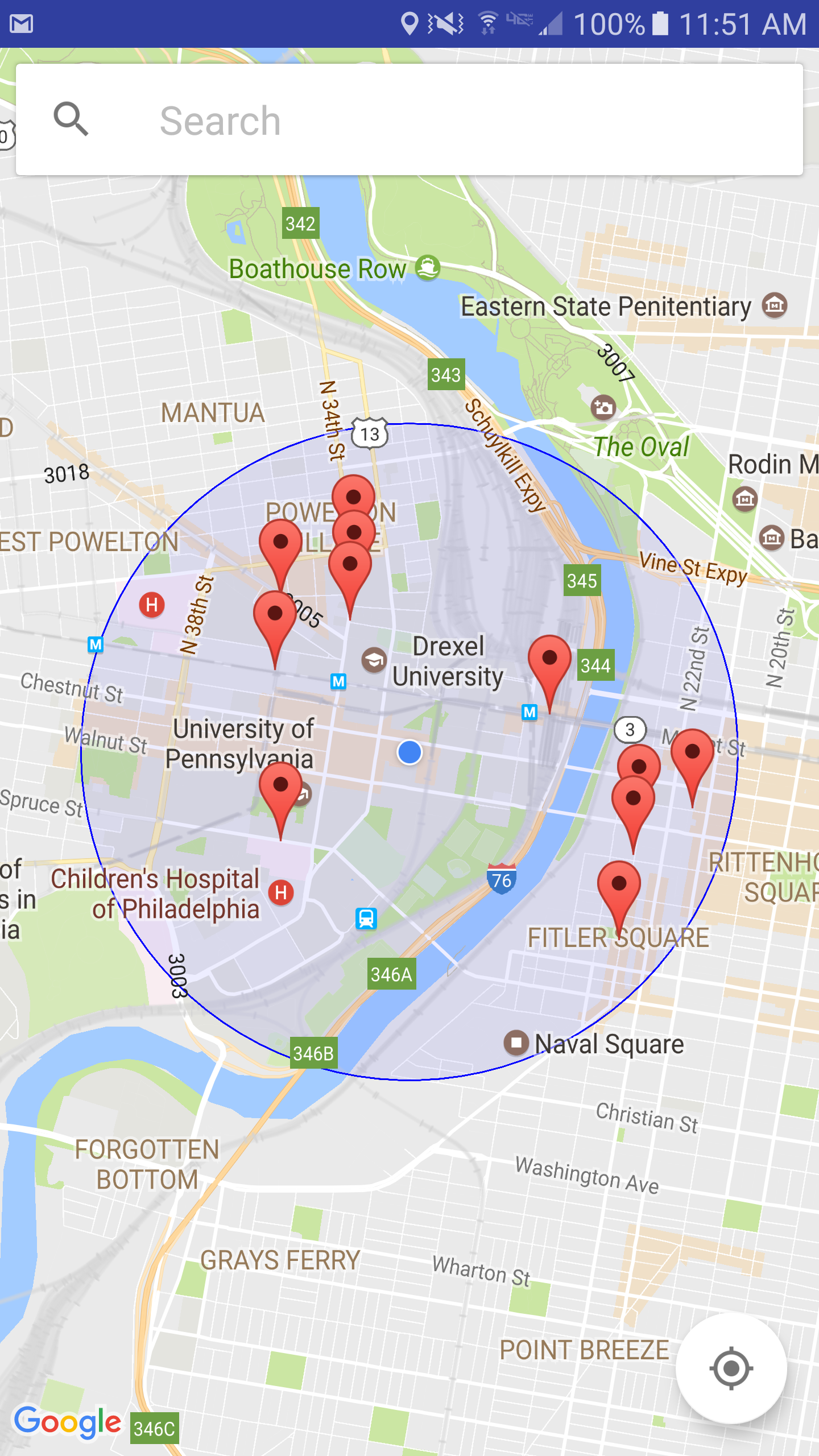
Safe Travels: show people where crimes have occurred recently so that people can be aware of their surroundings and make smarter and safer decisions.
What does the app do?
The app takes user's current location or an entered address in Philadelphia and shows markers on a map where crimes have occurred in past few weeks. That way, the user can be aware of what has happened and possibly avoid that area.
What's next for Safe Travels?
We plan to implement multiple features into this app that can help people make a safer decision. A few examples of features are:
- Smart Pathing: show a suggested route that avoids streets where crime has recently been reported
- Heat maps: show heat maps of crime based on historical data
- Filters: allow user to access crime by its specific type
These were just a few examples, we have a long way to go!


Log in or sign up for Devpost to join the conversation.